

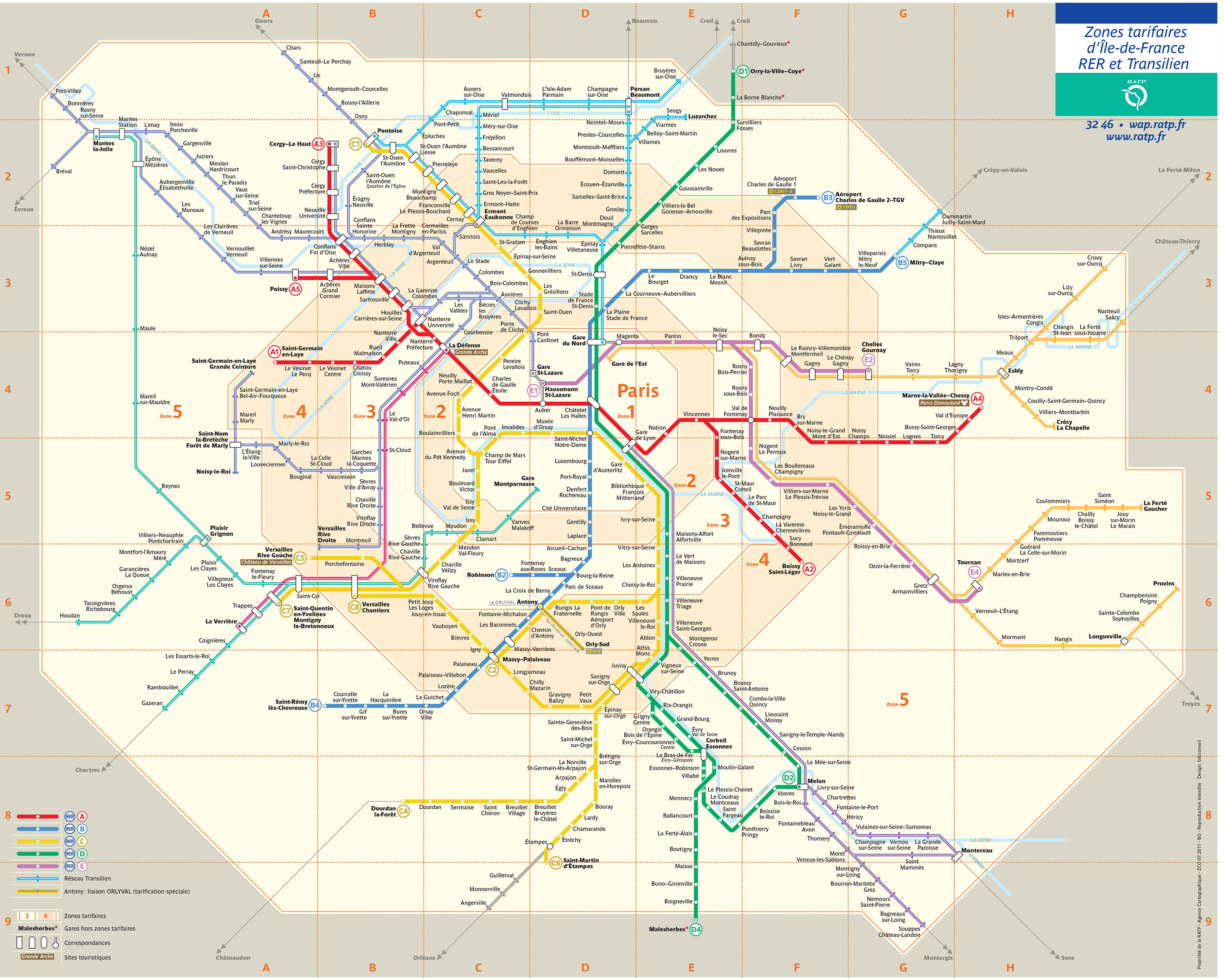
You can find on this page the map of Paris RER and the map of Paris Transilien. The Paris RER and Transilien are a transit system serving the city of Paris (France) with the subway, the tram, the bus or the Noctilien night bus. These 2 commuter train networks have 13 lines and 514 stations forming a rail network of 1,165 miles (1,875 km).
The interactive map of the RER and Transiliens in Île-de-France is designed to make your journeys easier, especially during a strike. Disruptions on the RATP and SNCF networks due to strikes, incidents or work can degrade traffic. To view the lines that normally operate, the RER and Transiliens map is available online and can be downloaded in PDF format.
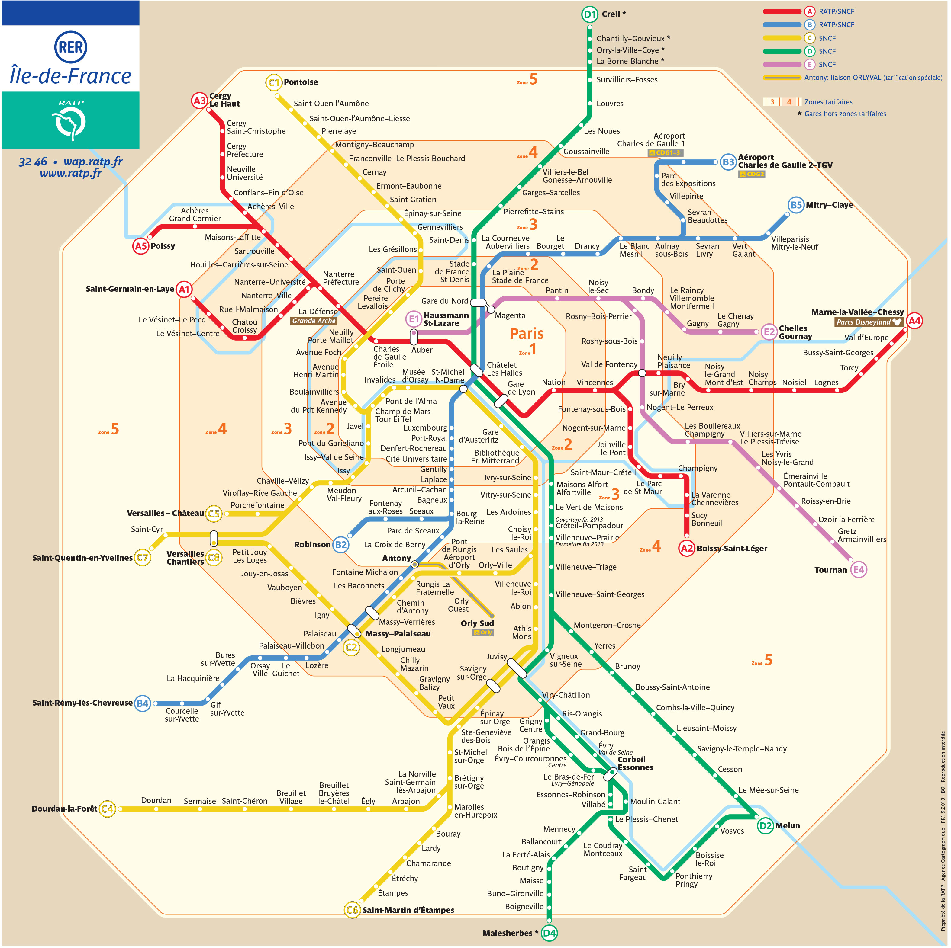
The RER trains which transport 2.7 million passengers per day, exist since 1977 and are operated by the RATP (Régie autonome des transports parisiens) and the SNCF (Société nationale des chemins de fer français).
Its network includes the following 5 lines:
Le réseau express régional d'Île-de-France, appelé « RER » en France, est un réseau de transport en commun desservant Paris et son agglomération. Il fait partie du réseau régional dénommé Transilien.
Composé de cinq lignes, il comporte 249 points d'arrêt pour 587 km de voies :
The Transilien trains of Paris which transport 2.9 million passengers per day, exist since 1999 and are operated by the SNCF (Société nationale des chemins de fer français).
Its network includes the 5 RER lines and the 8 following lines:
The "Transilien" is the rail network that serves the Paris suburbs and crosses the Ile-de-France region. The first line, which saw the light of day in the first half of the 19th century, linked the Saint-Lazare station to Saint-Germain. Until the 1990s, these suburban trains had the reputation of being uncomfortable, unpunctual and poorly maintained. To improve its image and increase the visibility of its network, in competition with RATP, SNCF launched the "Transilien" label in 1999.
The Transilien network accounts for 75% of regional rail traffic, 4,000 kilometres of track and more than 400 stations.
The Transilien's layout makes it possible to locate in a heterogeneous and complex network.


